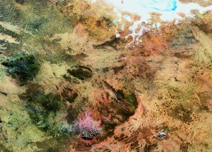
Uluru (formerly referred to as Ayers Rock) has been imaged from space by the Landsat 5 satellite.

The text from the European Space Agency media release that accompanied the image states: ‘This Landsat 5 image, acquired on 18 May 2011, takes us to the Amadeus Basin in the heart of the Australian outback. Two large rock formations are visible on the lower section of the image. The group of 36 domed rock formations to the west (left) is the Kata Tjuta with the tallest dome, Mount Olga, reaching 1066 m above sea level. Forty kilometres east of Kata Tjuta is Ayers Rock, known to the Aboriginals as Uluru. The white area at the top of the image is the salt-crusted Lake Amadeus.’